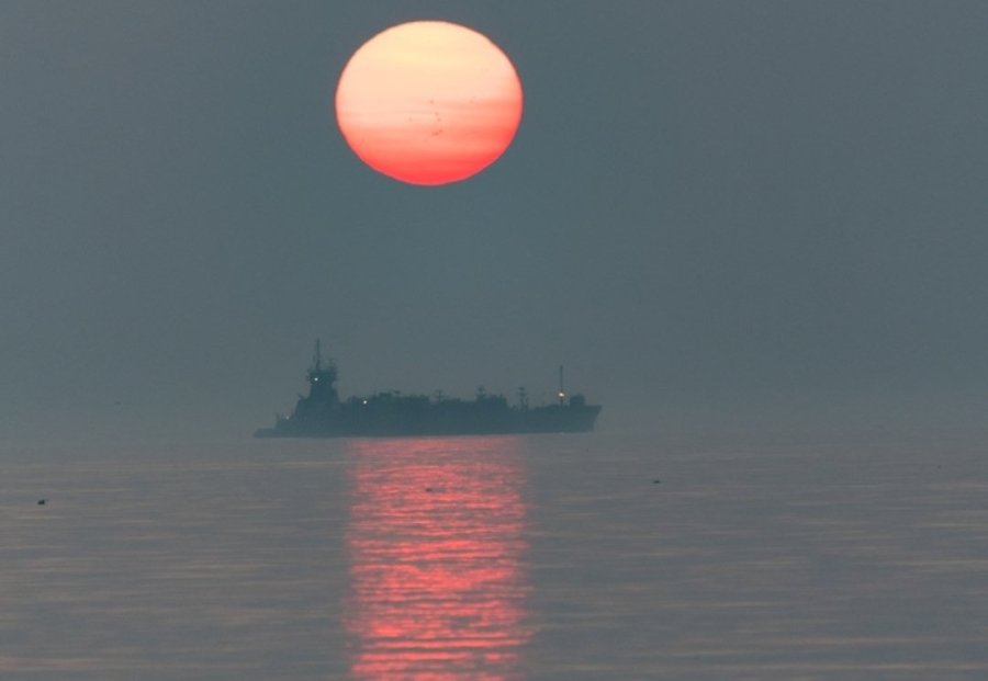
Matt Frank watched the sun come up over the ocean off Winthrop this morning in the haze from forest fires way out West.
Neighborhoods:
Free tagging:
Like the job UHub is doing? Consider a contribution. Thanks!
Ad:
Matt Frank watched the sun come up over the ocean off Winthrop this morning in the haze from forest fires way out West.
Like the job UHub is doing? Consider a contribution. Thanks!
Ad:Help keep Universal Hub going. If you like what we're up to and want to help out, please consider a (completely non-deductible) contribution.
Comments
Did BPHC say anything about
By Rwgfy
Sun, 07/28/2024 - 11:11am
Did BPHC say anything about this?
They said GTFO
By SwirlyGrrl
Sun, 07/28/2024 - 3:44pm
And, yes, there are air quality alerts out - issued by the state. Cities and towns sometimes provide additional alerts and info, but air pollution alerts are a state DEP job.
I'd love to see your epidemiology and public health credentials - and, no, yelling at yer mom to stick a meat thermometer into the hot pockets she brings you doesn't count.
Beautiful
By mg
Sun, 07/28/2024 - 12:24pm
Sad for the cause, but very much appreciate this beautiful picture.
Seeing haze in VT
By merlinmurph
Sun, 07/28/2024 - 2:18pm
We've been in VT and even with the nice dry air we've had, it's really hazy and we figured it was from the fires.
Haze also here in the Adirondack Park.
By Lee
Sun, 07/28/2024 - 10:27pm
.
I'm looking at the ADKs right now
By merlinmurph
Mon, 07/29/2024 - 8:17am
And last night's sunset was fiery red
Good Resource for Wildfire Smoke Pollution
By SwirlyGrrl
Sun, 07/28/2024 - 3:50pm
You can even see the plumes and the fires that are generating them - and not just in the US: https://www.airnow.gov/wildfires/
https://www.airnow.gov is a great general resource for air pollution information - not just alerts and measures, but explanations, too.
The state's page is here: https://eeaonline.eea.state.ma.us/dep/massair/web/...
And, finally, measurements from citizen, community organization, local health and state small area monitors can be seen on Purple Air's map: https://map.purpleair.com/
Airnow is what I use to
By Matt Frank
Mon, 07/29/2024 - 3:51am
Airnow is what I use to figure out if it's worth looking for a red sun. If it's green then it's not worth it, yellow is a good chance, orange is iffy but aim for a higher starting point on the horizon and red don't bother because I should be inside with filtered air anyway and it's like cloud cover. Overall clear skies with a yellow rating is the best time. That was my photo. The one posted later in the day from Chelsea by Chelsea scanner was yellow with cloud cover.
Purple Air is what I use for my own knowledge of local conditions for health reasons. Most of the sensors also get temps, humidity and heat index.
Purple air
By perruptor
Mon, 07/29/2024 - 5:43am
Me, hitchhiking west near Needles, CA about 1970, to a guy who gave me a ride: "What's that purple cloud?"
"That," he said, "is LA."
City of Smog
By SwirlyGrrl
Mon, 07/29/2024 - 8:25am
Friends moved to LA for school. They woke up one morning in October and realized that there were mountains in the distance that they hadn't seen yet.
Add comment