Hey, there! Log in / Register

Next car to Bass Point
By adamg on Tue, 08/25/2020 - 10:23am
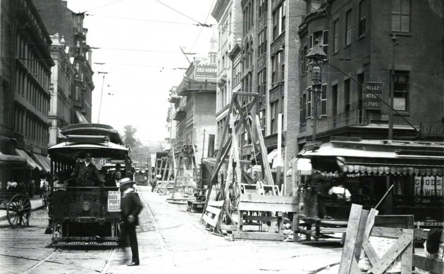
The folks at the Boston City Archives wonder if you can place this photo. See it larger.
Neighborhoods:
Topics:
Ad:
Support Universal Hub
Help keep Universal Hub going. If you like what we're up to and want to help out, please consider a (completely non-deductible) contribution.
Comments
Tremont Street
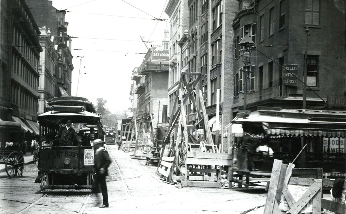
Looking northbound on Tremont Street, from the corner of Eliot Street (which is now called Stuart Street), circa 1897, with subway construction underway.
The giveaway is the view of the Common in the background.
The sign for "262 & 264 W[ashington St.]" is misleading because it's an advertisement for something that's a few blocks away. And only part of the ad is still visible, since the building it's painted on is under demolition, to make way for the Hotel Touraine. The Touraine opened in 1898 and still stands at the corner of Tremont and Boylston today.
The car is not going to Bass Point (Nahant), but it will take you to a wharf where you can get a steamship to Nahant.
I think that one of the buildings on the right is still there, across from the Majestic Theatre.
I can't identify the steeple that peeks up over the buildings in the center.
the steeple
looks like the park street church, but that would make tremont wrong and more likely winter st, so maybe its some other church
It Might Be The Masons Hall at Tremont and Boylston.
The hall was rebuilt at some point.
What I hate about this pic is what came afterwards (actually they are doing it here). A subway tunnel was built in 1897 right underneath here and it has been closed off since 1962. There could be a portal which would allow light rail access to the South End, Roxbury, and Mattapan, even from South Boston right under here to the Green Line.
However all we ever hear is "it would cost too much" "we'd have to do some work on it to bring it up to code". Except the state just approved $403M to being a few people each day up from Taunton, New Bedford, and Fall River rather than invest in public transit where it is needed the most.
Something is not right. https://www.wbur.org/news/2020/08/24/south-coast-rail-phase-1-contract-mbta
I just read this fascinating
I just read this fascinating article yesterday about Racism and Transit and how racism shapes it.
https://kinder.rice.edu/urbanedge/2020/08/24/transportation-racism-has-s...
Here's why (its in Denver but same principals apply here)
While we can brush South Coast Rail as going to communities who need it, particular communities that have a higher non-white population.
In short, you're right. SoCoast is being built for white commuters while the rest of the inner core suffers.
Camden Street
The last lines serving the portal were from City Point in a then, shall we say, the largest urban white slum in the US and from Camden Street in Lower Roxbury.
The South End, especially in the 40's and 50's was known as one of the most infamous places in Boston. The bus line that replaced the street car was known as The Burma Road for racist and other reasons. The Camden Street shops were sold to the BHA in the 60's for the development of the housing there now, thus taking away any way of keeping rail in the neighborhood and also freeing up rolling stock for the then new line that went to Brookline and Newton. As far as I can tell, even to this day, there seems to be a wee amount of financial disparity between Lower Roxbury and Beaconsfield.
I know it is great that Mike from Fairhaven can hop on the commuter rail someday rather than face the Death Race 2000 known as Route 140 and then 24, but there are bigger priorities than the goals of connecting Boston to the South Coast to appease some state reps and senators.
Time for the Boston group of reps and senators start throwing some weight around over so and so from Taunton or Somerset.
Burma Road?
Was this area of the South End at one time home to many South Asians?
More Sinister
There was always combat on the road, hence the name.
There's a street sign on the
There's a street sign on the corner to the right, near the sign that says DENTISTS DR. KELLEY DR. POST - it looks like it says Eliot Street.
Winter Street?
Winter Street?
I’m thinking West Street.
I’m thinking West Street.
How come there's no...
bike lane?
Ever ride a velocipede on
Ever ride a velocipede on cobblestones?
Besides, with pedestrians like the guy about to get flattened by the streetcar - who needs bicyclists?
If you want that experience today...
... try riding a bicycle around downtown Nantucket.
I don't know how someone in a
I don't know how someone in a wheelchair is supposed to get around that area. The crosswalks are brick, but sooner or later you have to go in the street.
But hey, at least they're not as obnoxious as Oak Bluffs on Martha's Vineyard, which not only bans riding bikes downtown (contrary to state law), but also bans WALKING them.
The Answer
Thanks for playing, folks!
Tremont and Eliot (now Stuart) Street is correct. The date is 1896, and so you're seeing subway construction.
So the instrument nor the
So the instrument or the fish?
Both work for Boston. The hub of the universe.