By adamg on Mon., 1/22/2018 - 11:33 am 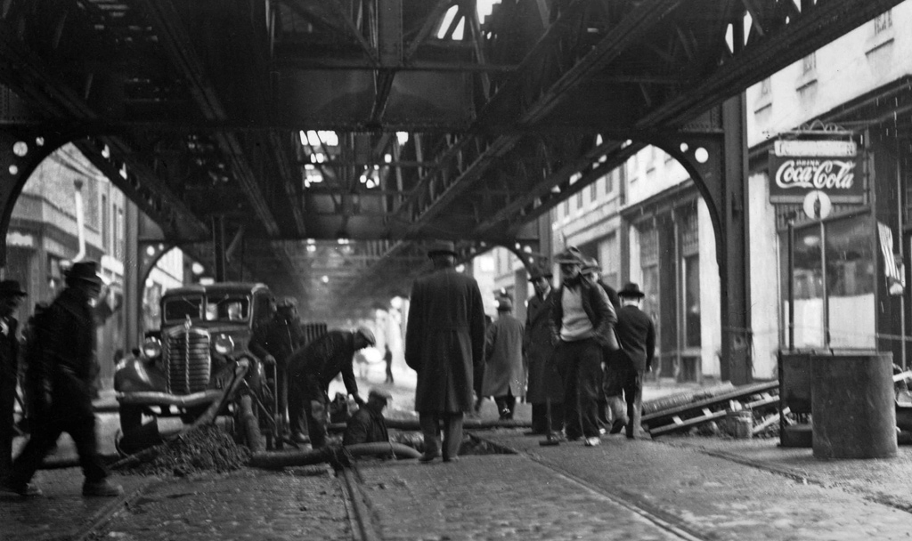
The folks at the Boston City Archives wonder if you can place this scene. See it larger.
Topics:
Neighborhoods:
Like the job UHub is doing? Consider a contribution. Thanks!
Ad:
The folks at the Boston City Archives wonder if you can place this scene. See it larger.
Like the job UHub is doing? Consider a contribution. Thanks!
Ad:Help keep Universal Hub going. If you like what we're up to and want to help out, please consider a (completely non-deductible) contribution.
Comments
Causeway Street
By Russ
Mon, 01/22/2018 - 11:53am
Anyone who's been to the North Station area before they put the green line underground can tell that it's Causeway Street. The date is somewhat difficult, though. I'm going with the 1930's.
Washington Street
By Hugo
Mon, 01/22/2018 - 11:58am
My first quick guess just based on the narrowness of the street is downtown on Washington Street.
I'm guessing
By Dalton Ames
Mon, 01/22/2018 - 12:11pm
Causeway street facing northeast towards the North End
Random, but educated number guess...
By capecoddah
Mon, 01/22/2018 - 1:20pm
3017 Washington St.
I don't think the Atlantic El used those supports anywhere.
I think the Atlantic Ave. El
By anon
Mon, 01/22/2018 - 2:46pm
I think the Atlantic Ave. El used those types of supports on Beach St. in Chinatown
Charlestown
By anon
Mon, 01/22/2018 - 2:49pm
Main street, 1930s.
causeway street
By Frank Rizzo
Mon, 01/22/2018 - 3:07pm
causeway street
Thanks for playing, folks!
By Boston City Archives
Mon, 01/22/2018 - 4:19pm
Thanks for playing, folks! In a surprise move, this is not Atlantic Avenue and its not Washington Street!
This photo shows Beach and Tyler Streets on March 28, 1939.
Buildings still there today
By Charles Bahne
Mon, 01/22/2018 - 7:42pm
A check on Google Street View shows that, amazingly, all the visible buildings are still there today. We're looking east on Beach Street, towards the current site of the Chinatown Gate.
Add comment