Hey, there! Log in / Register

Go home Google, you're drunk
By blues_lead on Tue, 11/24/2020 - 9:14pm
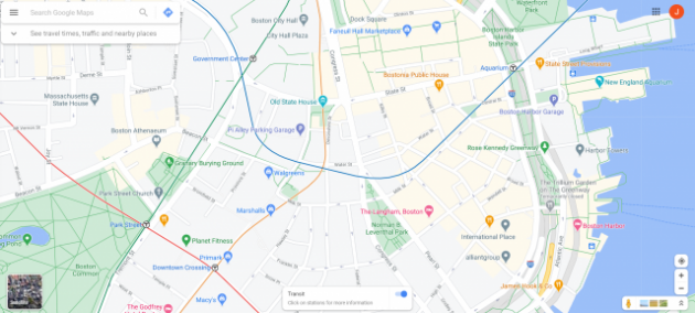
Google maps is taking some creative liberties with the Blue and Orange lines today.
Are we now a city without a State?
Neighborhoods:
Topics:
Ad:
Support Universal Hub
Help keep Universal Hub going. If you like what we're up to and want to help out, please consider a (completely non-deductible) contribution.
Comments
Blue Line Bell's Palsy
Perhaps this is the set up for the grand station under PO Square that we will get with the North / South link?
There *is* a T entrance at Water and Devonshire streets
from which you can get to the State Street platforms of both the Orange and Blue lines (the latter with a lot of underground walking). That seems to have misled Google into redrawing the two lines to intersect there.
Street View
For once, not the T's fault!
Probably some artifact of Google Maps. It's done something weird with the Red Line between Porter and Alewife (Davis is not on a sharp curve, for instance).
If you put in directions, the route that is drawn on the map matches the shape in GTFS, and the underlying map on Google Maps shows the transit line elsewhere.
The other option was "someone at the T too the time to draw the lines in the wrong place and uploaded that to GTFS" which doesn't seem to be the case!
a city without a State?
Yep.
We've got a Commonwealth.