
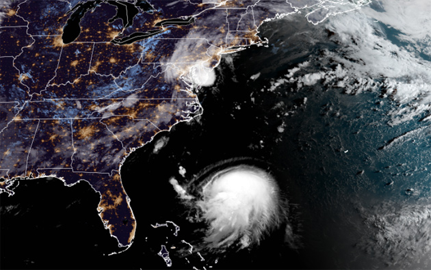
The blob approacheth. Henri at 6:40 a.m. Source.
The National Weather Service issued a hurricane watch this morning for the Cape and Islands, southern Plymouth County and the South Coast - not all that far from Newport, RI, where it now expects Henri to come ashore as a Category 1 hurricane around 2 p.m. on Sunday.
Then, instead of veering out to sea as initially thought, it will plow up the Blackstone Valley, winding up as a tropical storm right over Worcester by 2 a.m. on Monday.
Although the Watch areas will bear the worst of the storm - which could include damage from hurricane-force winds, coastal surges and all that rain, people further out, like, in, oh, the Boston area, should be prepared for rain and wind issues as well, NWS says.
Rivers and tributaries may quickly become swollen with swifter currents and overspill their banks in a few places, especially in usually vulnerable spots. Small streams, creeks, and ditches overflow.
Several places may experience expanded areas of rapid inundation at underpasses, low-lying spots, and poor drainage areas. Some streets and parking lots take on moving water as storm drains and retention ponds overflow. Driving conditions become hazardous. Some road and bridge closures.
And don't be surprised if some buildings have to evacuated - and if we see some storm surges, if not quite as bad as on the Cape, as far north as the Merrimack River. So plan on staying away from Morrissey Boulevard and Quincy Shore Drive.
Like the job UHub is doing? Consider a contribution. Thanks!
Ad:
Add comment