
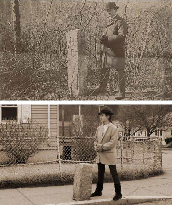
While perusing the city's photos of boundary checking in 1896, I noticed several were of markers with "HP" on one side, from back when Hyde Park was still an independent town. Hmm, could they have a photo of the one a couple blocks away from us?
Sure enough, they did, but it seemed a lot taller than I remembered it. So today, the kidlet and I went down to Dale Street to check out Marker 123. And as you can see from the photos, it is, indeed a lot shorter than it used to be.
One assumes granite doesn't just shrink like that, so what's the deal? A possible clue is on the map showing the marker in 1896: It features a creek running on the other side of Dale (down to Stony Brook on the other side of the train tracks), a small tributary just near the marker and marshes on either side of the street.
So no doubt when Windham and Sherrin streets were built, they first dumped several feet of fill in the land around the marker. Now, a 1912 map of Hyde Park, after it became part of Boston, doesn't show those streets. So when they were built, Hyde Park was part of Boston and there was no longer any need for a boundary marker and yet, the marker was left in place, albeit a few feet lower than it used to be.
Top photo from the City of Boston Archives. Posted under this Creative Commons license.
Like the job UHub is doing? Consider a contribution. Thanks!
Ad:
Comments
I've been poking around
By Matt
Tue, 10/16/2012 - 3:55am
I've been poking around looking for the markers. Did you ever make your map?