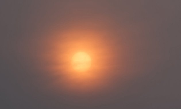
Hazy shade of spring
By adamg on Tue, 05/16/2023 - 9:29am

More smoke from wildfires on the Canadian plains gave us another hazy sunrise this morning, as Brooks Payne shows us.
Kichinichini took in the hazy sun from the River Street bridge in Hyde Park's Cleary Square:

Although we don't have massive prairies, we are entering another week of mostly dry (if possibly cold enough for frost) weather, like 17% relative humdity, so the local National Weather Service has issued a Red Flag warning for most of the state:
Any fires that start may spread rapidly and become difficult to extinguish.
Last week:
Smoky sun over Millennium Park.
Topics:
Ad:

Comments
Not smoke
Just clouds.
There is a bit of smoke up high, but, as the link you have linked shows, not much. There is some moisture at higher levels of the atmosphere, and as the west-northwesterly flow is forced up over the Greens and Berkshires, it is compressing this air just enough that it is forming cirrus clouds up at 22000' (according to the latest METAR for BOS), the NWS Albany office is calling these "terrain-forced standing waves": basically, as winds blow across the Green Mountains and are forced upwards, they create turbulence which creates the conditions for moisture to be lifted and compress into clouds. Overnight there was more widespread cloud cover, but this morning it is more clearing coming off the Greens. And, no, it doesn't matter that these are relatively small mountains; here's an explanation of how even punier mountains in Minnesota do the same thing.
tl;dr: this is sun being filtered through cirrus clouds 20,000 feet above you, not Canadian smoke.
Then what's with the yellow?
Yellow usually means high particulate matter loading. Pollen levels are at the top of the scale - could the coloration be pollen?
Don't confuse us with facts.
Don't confuse us with facts.
Not to disagree with you but
Not to disagree with you but I disagree with you. The map is a forecast map. If you look at the real time maps there is indeed a smoke cover in the area filtering the sun. Right now as we speak the line between two levels is over East Boston and Chelsea despite not showing up on the forecast map.
I've been following the smoke from these and past fires because I like how the sun looks red setting in the distance and I've had images from this affect every year for the past few years, including one that was bought by a company being featured on their website and a digital billboard last year.
The light is filtering very oddly and that's not from the clouds.
If this current smoke cover holds stready we may have another crimson sunset which is a definitive marker of smoke in the atmosphere. The red sun with almost no variation in the rest of the sky is a definitive indicator. It will be interesting to see how things look at 7pm or if too many clouds come rolling in.
If you Google Boston Wildfire
If you Google Boston Wildfire smoke you'll see the real time air quality map and can see there's literally a line that cuts across Chelsea, Ptown and Amherst right now as I type despite not showing up on the forecast.
Are you sure?
Are you sure?
I thought it was very cool
I thought it was very cool looking. But I too just thought it was regular clouds. So now I know if the sun is yellow the day will be mellow.